


Login
Get Instant Pricing On 23,000+ Aircraft

>
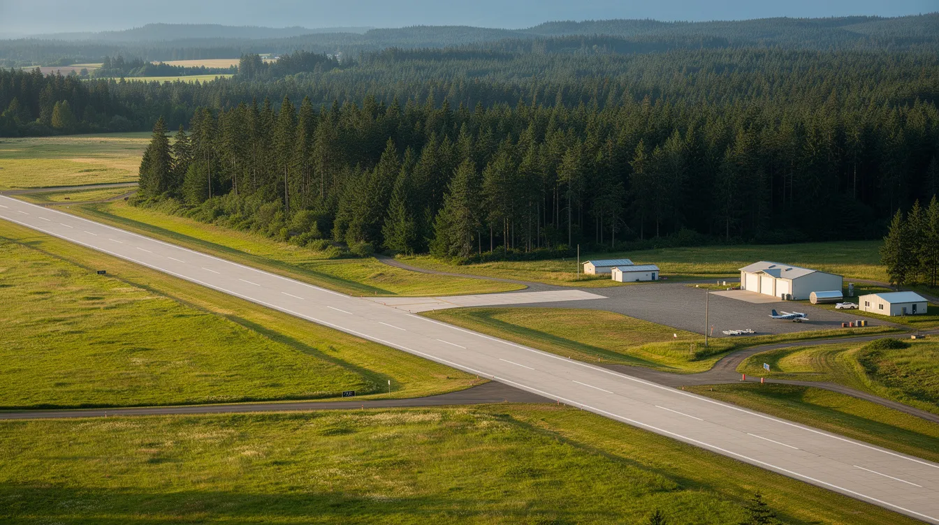
Quillayute Airport (UIL) is a public general aviation airport in Clallam County, Washington, about 10 miles west of Forks on 739 acres of former military prairie. Quillayute Airport is a public-use general aviation airport. Established in the late 1930s, it was originally built as a naval air station during World War II and is now owned by the City of Forks, which acquired it in 1997. It serves pilots, aviation operators, private and charter travelers, and frequent flyers looking for practical air access to the Olympic Peninsula. This guide is intended for pilots, private travelers, charter operators, and anyone interested in the operational and historical details of Quillayute Airport. This guide explains the airport’s WWII origins, current runway and facility data, instrument access and emergency-response role, and travel planning details that matter if you’re considering a private charter into one of the most remote stretches of the Pacific Northwest coast. Quillayute Airport is a critical access point for the Olympic Peninsula, supporting both general aviation and emergency operations.
For travelers and operators, Quillayute Airport is more than a local field: it can save significant time versus commercial connections and remains a critical access point when weather, distance, or road disruptions affect the region. If you’re evaluating whether UIL works for a private flight, this introduction gives you the key context before you book through Jettly or plan an arrival on your own.
Quillayute Airport (UIL), formerly Quillayute State Airport, is a public general aviation airport in Quillayute, WA, with World War II naval auxiliary air station roots, owned by the City of Forks.
The airport has one active concrete runway (4/22) measuring 4,211 by 100 feet with a 1,089-foot displaced threshold; runway 12/30 is closed; about 6,700 annual operations in 2022.
Federal Bipartisan Infrastructure Law funding supports runway maintenance, hangar restoration, and safety improvements, with plans for restrooms, runway lighting, and satellite-based instrument procedures.
Located outside the tsunami danger zone, Quillayute Airport serves as a staging site for emergency response on the Olympic Peninsula, where road access is often disrupted.
Jettly helps private charter travelers reach Forks and the Olympic Peninsula by routing flights into Quillayute or nearby airports, depending on aircraft, weather, and runway constraints.
Quillayute Airport (FAA identifier: UIL) is a public-use general aviation airport located in Clallam County, Washington, approximately 10 miles west of Forks. The facility was formerly named Quillayute State Airport before ownership transferred from the state to the city. Its field elevation is 194 feet above mean sea level.
The airport primarily supports general aviation and recreational flying. Typical users include private pilots, air ambulance operators, state and federal agency aircraft, and occasional charter flights. Travelers considering private charter can apply tips for booking the cheapest private jet flights when evaluating options into UIL or nearby airports. There is no scheduled commercial airline service, and the airport does not have customs or port of entry services. It functions as an uncontrolled field without a control tower, operating mainly as a utility-focused field for the Olympic Peninsula rather than a passenger hub. Quillayute Airport has no control tower and operates as an uncontrolled field.
Access to the airport is primarily by car from Forks via Quillayute Road. Pilots must bring their own tie-downs since no tie-down equipment is provided, and there are no fuel services available on-site. An Automated Surface Observing System (ASOS) is available for weather updates.
In 1997, the airport property was deeded to the City of Forks by the Washington State Department of Transportation, which had managed the property since the state took ownership in 1962. The airport covers 739 acres and holds public-use status under the FAA's National Plan of Integrated Airport Systems. It is distinct from the smaller Forks Municipal Airport and serves as an emergency alternative to that field, fitting the broader landscape described in guides to private and charter airlines that highlight how secondary fields support regional access.
Jettly can arrange private charter flights to this region. Depending on aircraft type and operational constraints, the platform may route flights directly into Quillayute or to other nearby airports such as William R Fairchild International (KCLM). Travelers can compare options, use Jettly's airport locator tool, and get charter pricing through Jettly's digital booking tools.
Quillayute Airport began as a U.S. Navy installation before its conversion to a public airport. The site was established in the late 1930s when the War Department identified the Quillayute Prairie as a suitable location for coastal defense aviation.
In 1940, 520 acres were purchased for $24,400. Runway construction began in October 1941 using concrete mixed with local sand and gravel from the nearby Rialto Beach area. The Naval Auxiliary Air Station Quillayute was commissioned in February 1944. During the war, the air station supported B-24 bomber patrols, P-38 fighter training, and blimp operations for coastal surveillance. The original military footprint spanned over 1,200 acres and included two concrete runways, hangars, ordnance storage, barracks, and extensive taxiways.
After the war ended, the Navy declared the station excess in June 1946. Approximately 110 military buildings were surveyed, appraised, and either removed, sold, or repurposed by 1947. The State of Washington acquired the property in 1962 to maintain it as an emergency landing site. The City of Forks took ownership in the late 1990s, and UIL's NPIAS designation shifted from Forks Municipal to Quillayute.
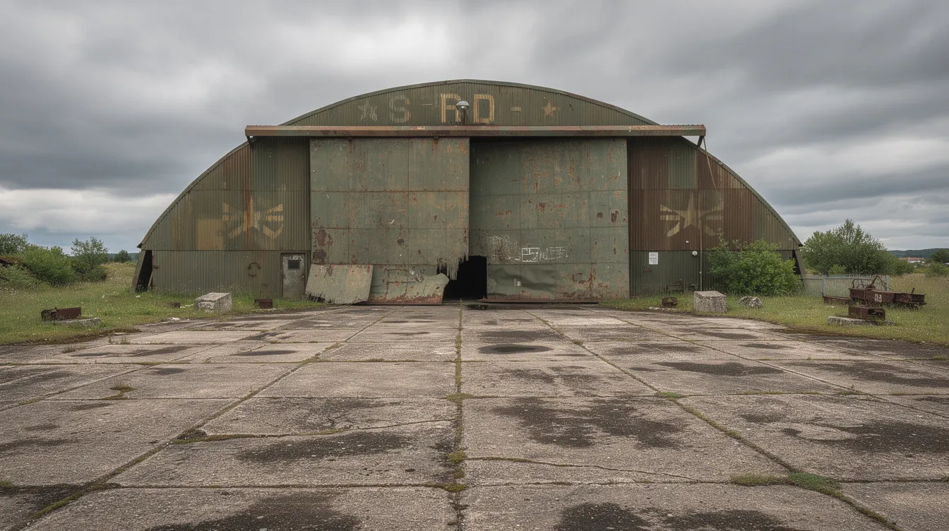
Several WWII-era structures remain on site. Two large hangars (one built by the Austin Company) still stand, along with old taxiway segments, ramp hardstands, and building foundations. These remnants shape the modern airport's footprint and present both preservation challenges and redevelopment opportunities. The city issued a request for qualifications in recent years for architecture and engineering services to stabilize the historic southern hangar extension and repair its roof.
The airport's location, set back from the coastline and outside the tsunami danger zone for La Push, was chosen for a reason. The Forks municipal field was too constrained for expansion. Quillayute's prairie site allowed larger runways while remaining close enough to the coast for defense operations, making it suitable for cross-country-capable aircraft that balance range, performance, and utility. That same geographic advantage now makes the airport relevant for modern disaster-preparedness planning on the Olympic Peninsula.
Quillayute Airport is a large airfield relative to its current traffic levels. The site includes multiple former runways, one primary active runway, basic general aviation facilities, and no commercial passenger terminal. There are no fuel services available on-site, and the airport has no control tower; it operates as an uncontrolled field.
Two concrete runways were originally built, each nearly 5,000 feet long. Today, only one is active:
|
Runway |
Dimensions |
Surface |
Status |
|---|---|---|---|
|
4/22 |
4,211 ft × 100 ft |
Concrete |
Open (displaced threshold: 1,089 ft) |
|
12/30 |
~5,000 ft |
Concrete |
Closed |
The single active concrete runway designated as 04/22 carries a displaced threshold of 1,089 feet, which reduces usable landing distance for aircraft on approach.
In 2022, the airport had 6,700 aircraft operations. Of those, 97% were general aviation and 3% were military flights. For travelers comparing Jettly with other top private jet charter companies, UIL exemplifies the kind of regional field where on-demand services add flexibility beyond major airline hubs.
Regarding instrument procedures, the airport has been coordinating with the FAA to develop satellite-based (SATNAV/GPS) approaches. According to the 2024 Quillayute Airport Master Plan, developing these procedures is a high priority, with preliminary coordination underway. Pilots should check current approach plates before planning IFR operations, especially if integrating UIL into broader international private jet routes and regulations. Published instrument procedures allow properly equipped aircraft to operate in reduced visibility, which matters on the Washington coast where low ceilings, fog, and rain are common for much of the year, and December is typically the coldest month along this stretch of coast.
Ground facilities include the apron and parking areas, WWII-era hangars in varying states of repair, and a NOAA weather station. The airport has an Automated Surface Observing System (ASOS) available for weather updates. There is no large FBO, no passenger terminal, and pilots must bring their own tie-downs since no tie-down equipment is provided, making it especially important for charter customers to select private charter aircraft that match UIL’s limited ground services. The facility is practical and utility-focused rather than built around passenger convenience.
The City of Forks designates an airport manager responsible for day-to-day oversight, maintenance planning, and coordination with the FAA and Washington state agencies. As of recent FAA records, Rod Fleck of Forks holds this role.
Key safety and infrastructure priorities include:
Runway and taxiway surface maintenance: crack sealing, repainting, and drainage improvements on aging concrete
Vegetation removal around approach paths, including 70-foot trees noted in the runway 4 obstruction area
Ensuring clear approach and departure paths, wildlife management for animals on the airfield, and compliance with FAA safety regulations for public airports
Under the Bipartisan Infrastructure Law, Quillayute Airport received an allocation of $108,000 in the FAA's Airport Infrastructure Grant program for FY 2025. This funding targets basic safety compliance work, including pavement rehabilitation and apron resealing. Separately, the city has pursued BIL funds to stabilize the historic WWII hangar's southern extension, repair its roof, and install a commercial septic system to enable future commercial use of the building.
Plans include adding restrooms and installing runway lighting, along with updated navigational aids and the establishment of GPS-based instrument approaches. These projects, while modest in scope for a 739-acre airfield, directly improve both everyday general aviation usability and the airport's readiness for emergency operations during regional disasters, and they also make the field more attractive to operators such as Dexter Air Taxi and similar charter providers.
Quillayute Airport is located outside the tsunami danger zone for La Push and the surrounding coast. Its inland position on elevated prairie land, combined with proximity to vulnerable coastal communities, makes it one of the most important emergency aviation assets on the Olympic Peninsula.
The strategic case rests on specific geographic risks:
The Cascadia Subduction Zone runs offshore. A major earthquake along this fault could severely impact the region's safety, triggering tsunamis that would threaten lower-lying communities, including the Quileute Reservation at La Push.
Highway 101, the primary road serving the western Olympic Peninsula, is regularly disrupted by landslides and flooding. After a large seismic event, road access could be severed for days or weeks.
Quillayute Airport can serve as a staging ground for rescue, relief, medical evacuation, and supply flights when surface transportation fails.
Quillayute Airport is vital for emergency operations during disasters. It serves as an emergency alternative to Forks Municipal Airport, which is smaller and more constrained. Scenarios where UIL becomes critical include airlift operations by state and federal emergency-management agencies, evacuation or medical transport for residents and visitors when coastal routes are compromised, and helicopter or fixed-wing supply missions when Highway 101 is blocked, where flexible, on-demand platforms that serve as a NetJets alternative for private flying can be particularly useful.
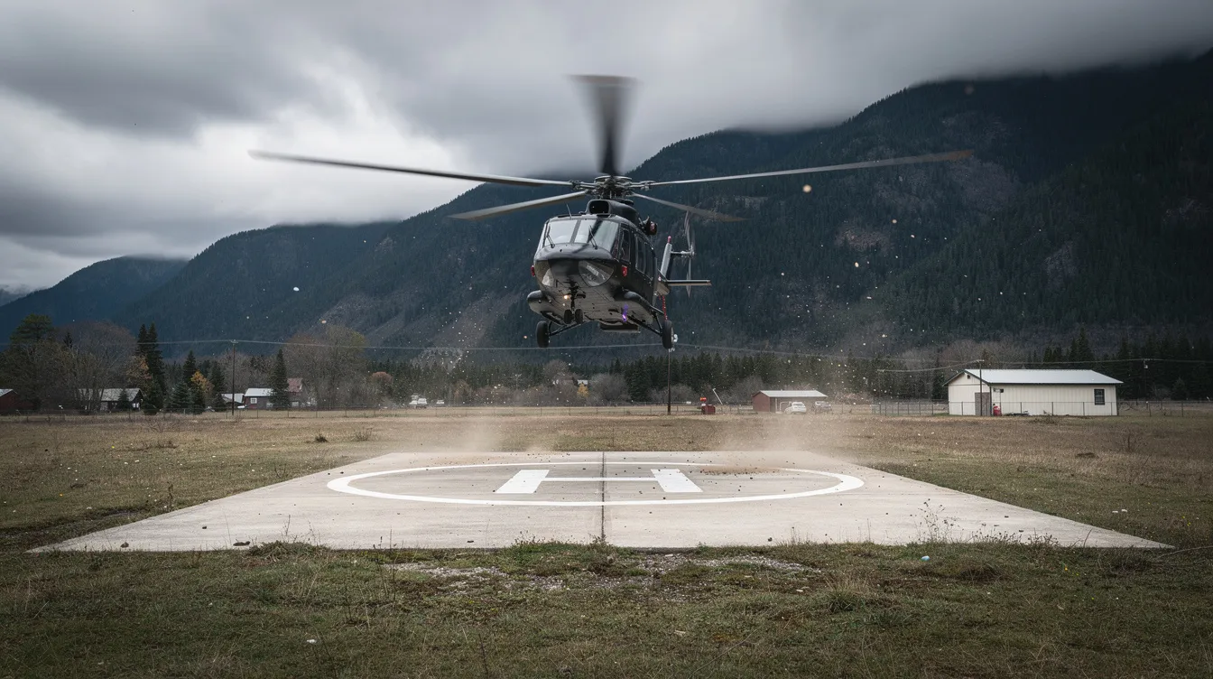
Community and institutional partnerships reinforce this role. The Olympic Natural Resources Center has hosted public presentations exploring the airport's disaster-preparedness potential. The City of Forks, tribal governments, and emergency-management agencies have engaged in long-term resilience planning that treats the airport as critical infrastructure. Keen has promoted the airport as a key asset since 2015, and plans include restoring the airport for future disaster preparedness.
Improved infrastructure, from resealed runways to lighting and durable backup power sources, helps ensure the facility can operate even when regional systems are under stress. For emergency and disaster response charter flights, having a functional airfield outside the tsunami zone is not optional; it is the difference between reaching isolated communities and being unable to help.
While Quillayute Airport is general-aviation oriented, private charter flights can operate there when runway length, weather, aircraft performance, and operator approvals align. For travelers who need to reach Forks, La Push, or the western Olympic Peninsula quickly, it offers a direct alternative to driving several hours from Seattle.
Jettly connects travelers to a large network of on-demand charter operators. The platform allows customers to search, compare, and book aircraft suited to shorter runways and regional airports like Quillayute. Pricing is transparent, booking is digital, and flight plans are tailored around client schedules rather than commercial airline timetables. Frequent flyers may benefit from Jettly's private jet memberships, while travelers unfamiliar with chartering can review Jettly's guide on how to charter a plane.
When Quillayute is unavailable due to weather, crosswind limitations (with runway 12/30 closed), or aircraft performance constraints, nearby airports serve as alternatives. William R Fairchild International (KCLM) in Port Angeles has longer runways, established instrument approaches, and more ground services. Jettly helps travelers evaluate which field best fits their aircraft type, payload, and ground-transportation needs, and can also facilitate crowdsourced private jet flights and shared empty seats when appropriate.
Concrete use cases include, for travelers watching their budget and wondering how much it costs to rent a private jet:
A film-production team chartering a turboprop from Seattle to reach the Forks area for on-location shooting. The crew lands at UIL, then drives 10 miles to town. If weather drops below approach minima, the operator diverts to Fairchild International with a longer ground drive.
A family traveling privately for a coastal hiking and fishing trip, landing at an airport near Quillayute, WA, to save four to five hours compared with driving from Seattle or Portland, using strategies for getting a seat on a private jet easily such as memberships or last-minute deals.
A time-sensitive medical or corporate logistics trip, where operators use Quillayute's instrument procedures to maintain access during marginal coastal weather conditions and may plan budgets with a jet card flight cost estimator to understand hourly pricing in advance.
Ready to explore private travel to the Olympic Peninsula? Review Jettly's charter options and instant pricing at jettly.com.
This section covers the practical details for pilots, charter customers, and travelers heading to Forks, La Push, or Olympic National Park destinations via Quillayute Airport or nearby fields.
For pilots and operators:
Check current NOTAMs before flight. Runway 12/30 remains closed, and any limitations on night operations or lighting should be confirmed, as runway lighting installation is still in the planning phase.
Review current instrument procedures, approach minima, and local weather patterns. The ASOS on-site provides real-time data, but coastal conditions can change rapidly. CDC Seattle ARTCC can provide additional information for flights transiting the area.
Coordinate with the airport manager in advance for parking arrangements, hangar availability, or special operations. The field has no fuel services and no tie-down equipment; pilots must bring their own tie-downs.
Access to the airport is primarily by car from Forks via Quillayute Road. There is no on-airport ground transportation service.
For travelers arriving by private charter: Many first-time flyers also explore options for buying a single seat on a private jet rather than chartering an entire aircraft, especially on popular regional routes.
Arrange ground transportation ahead of time. Rental car pickups, car services, or local shuttles should be booked before departure, as on-site services are limited. Those flying private for the first time should know that at airports like UIL, there is no commercial terminal; arrivals are handled directly on the ramp, with boarding and deplaning steps from the aircraft.
Coordinate timing with the operator. Quillayute is less staffed than major hubs and may require advance notice.
The airport does not have customs or port of entry services, so international flights must clear customs at another facility before proceeding to UIL.
Integrating Quillayute into an Olympic Peninsula itinerary:
Pair a private flight with visits to Forks, Rialto Beach, La Push, the Hoh Rain Forest, or other nearby attractions. Chartering via Jettly allows flexible same-day or weekend itineraries that cut total travel time from a full day (flying commercial into Seattle, then driving three-plus hours) to under two hours in the air from western Washington airports, and frequent travelers might compare this approach with structured jet card programs for corporate and luxury travel.

Treat Quillayute Airport as both a convenient access point to a remote region and a piece of local infrastructure that serves the community's safety and future. Plan accordingly and use resources like the Jettly cost estimator and broader guides on how much a private jet costs to own or charter to compare routing options before booking.
Below are answers to common questions travelers and pilots ask about Quillayute Airport and chartering flights to Quillayute, WA.
Yes. Quillayute Airport is the current public name for the facility formerly known as Quillayute State Airport. The name changed after ownership transferred from the Washington State Department of Transportation to the City of Forks in the late 1990s. Older documents, charts, and some NOAA weather reports may still reference the former designation. The FAA identifier (UIL) and ICAO code (KUIL) have remained the same.
No. The airport does not offer scheduled commercial airline service. Travelers flying commercially typically route through Seattle-Tacoma International Airport and then drive approximately three and a half hours to Forks. Jettly can help coordinate direct charter service into Quillayute or nearby fields like William R Fairchild International, cutting that transit to a fraction of the time.
The primary runway's 4,211-foot length and concrete surface support a range of general aviation aircraft: single-engine and multi-engine pistons, turboprops, and many light jets. Some midsize jets can operate under favorable conditions (dry runway, light payload), but the displaced threshold reduces usable landing distance to roughly 3,100 feet for arrivals. Pavement strength is rated for single-wheel loads up to 30,000 lbs and dual-wheel loads up to 50,000 lbs. Suitability always depends on specific aircraft performance data, weather, and operator approval.
The airport is in the process of developing satellite-based (GPS/WAAS) instrument approaches, with coordination underway between the City of Forks and the FAA as of the 2024 Airport Master Plan. Pilots should verify current published procedures and approach minima before planning IFR flights. The area's frequent low clouds, rain, and fog make reliable instrument procedures essential for year-round usability.
Jettly enables users to search a large fleet of charter aircraft, compare instant pricing, and choose vehicles capable of operating into Quillayute Airport or nearby fields. The platform helps coordinate timing, aircraft selection based on runway constraints, and ground transportation connections so travelers can minimize total travel time to Forks and the Olympic Peninsula. For those seeking unlimited access to booking tools and fleet data, creating a free account on the website opens the full range of search and comparison features.
Ready to experience private travel on your terms? Whether you are comparing Jettly with established providers such as NetJets and other industry leaders in private aviation or just exploring on-demand options, you can explore flight options or request a quote at jettly.com.
Quillayute Airport remains a vital aviation asset on Washington's Olympic Peninsula, blending a rich World War II history with a practical role in modern general aviation and emergency preparedness. Its strategic location outside the tsunami zone, combined with ongoing infrastructure improvements and planned instrument procedures, ensures it will continue to serve private, charter, and emergency operations effectively. For travelers seeking efficient access to Forks, La Push, and the surrounding region, Quillayute offers a time-saving alternative to commercial flights and long drives.
Jettly’s platform simplifies private jet charter to this remote area, providing transparent pricing, instant booking, and aircraft options suited to Quillayute’s runway and operational conditions. Whether for business, leisure, or urgent travel needs, Quillayute Airport is a key gateway to the Pacific Northwest coast.
Ready to experience private travel on your terms? Whether you are planning regional hops like Seattle–Quillayute or long-range itineraries similar to private jet charter in Kolkata, West Bengal, or charter services in New Delhi, India, explore flight options or request a quote at https://www.jettly.com.
Share this post:
Jay Franco Serevilla
Aug 15, 2026
|
5
min read
Discover tips and trends in the industry.
5
min read
Celebrity Jet Tracking: Jack Sweeney, Public Data, and the Future of Private Jets
Celebrity jet tracking has emerged as a significant topic at the intersection of technology, privacy, and environmental accountability. Initiated by Jack Sweeney, this practice involves monitoring and publicly sharing the flight movements of private jets owned by celebrities, raising important discussions about privacy, safety, and the environmental impact of private aviation. As public interest grows, platforms like Jettly adapt to meet the evolving expectations of privacy and responsibility in private jet travel.
Read More
5
min read
Best Time to Book Flight for December: How to Lock In Christmas Flights at the Best Prices
Booking flights for December, especially around Christmas, requires strategic planning to secure the best prices. The ideal booking window typically falls between 33 and 67 days before departure, with early September being the time to start tracking fares. Flexibility with travel dates and routes can lead to significant savings, making it crucial to understand fare patterns and dynamics during this peak travel season.
Read MoreStay updated with our latest insights and tips to elevate your journey with us.
MEMBERSHIPS AND ASSOCIATIONS



Disclaimer: Jettly operates as a charter broker, offering access to a global digital jet charter marketplace. Jettly is not a direct air carrier and does not own or operate aircraft. All advertised flights are conducted by third-party air carriers that are fully licensed and hold the appropriate Part 135 or Part 121 certifications issued by the Federal Aviation Administration (FAA) or equivalent regulatory authorities under U.S. or foreign law. Jettly complies fully with the U.S. Department of Transportation's Part 295 and Part 298 Charter Broker regulations. Jettly does not carry additional liability insurance. Passengers are covered by aircraft operator insurance. TICO: 50023770


