



Login
Get Instant Pricing On 23,000+ Aircraft

>
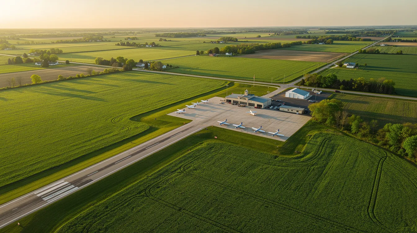
KHHG is the ICAO code for Huntington Municipal Airport in Huntington, Indiana, a city-owned airport a few miles southeast of downtown that serves general aviation, corporate, air taxi, and private charter traffic. For business and leisure private jet travelers headed to northeast Indiana, it offers a practical alternative to larger commercial airports, with direct regional access and the flexibility private flyers typically want. Jettly arranges charter flights to and from KHHG, helping travelers compare aircraft options, evaluate airport suitability, and book service that fits this compact but capable airfield.
This guide focuses on the details that matter when planning a private flight through KHHG: airport location, runway and facility constraints, instrument procedures, nearby alternate airports, ground access, and how Jettly's digital charter platform supports instant booking, aircraft selection, and potential empty leg opportunities.
Huntington Municipal Airport is located in Huntington, Indiana, approximately 3 statute miles (4.8 km) southeast of the city center. The airport's surveyed elevation sits at roughly 806 ft (246 m) above mean sea level - a figure that matters because higher elevations reduce air density, which in turn affects engine output and wing lift during takeoff and landing. At 806 ft, performance impacts are minimal for most charter aircraft, but pilots still factor elevation into weight and distance calculations, especially during hot summer months.
The airport's geographic coordinates are approximately 40°51′N, 85°27′W, placing it squarely in northeastern Indiana between Fort Wayne and Marion. The field falls within the Eastern time zone and was originally activated in December 1942. It does not have a control tower, so pilots self-announce on the common traffic advisory frequency (CTAF).
KHHG is recognized as a four-letter ICAO code in aviation, while the FAA identifier for Huntington Municipal Airport is HHG. Interestingly, KHHG was previously assigned as a radio station call sign in Hico, Texas, and the radio station using KHHG operated from 2010 to 2012 - a piece of trivia that occasionally causes confusion in online searches.
The airport primarily serves general aviation, corporate traffic, air taxi and charter operations, and occasional flight training. Travelers comparing different private aviation providers and the broader list of charter airlines will find that on-demand charter works especially well at airports like KHHG. No scheduled commercial airlines operate here.
Key facts at a glance:
Location: ~3 mi SE of Huntington, Indiana
Elevation: ~806 ft / 246 m AMSL
ICAO code: KHHG | FAA code: HHG
Ownership: City of Huntington (municipal)
Operations: GA, charter, corporate, air taxi - no commercial service
Attendance: Mon–Sat 0800–1700 local; Sun 1200–1700 local; unattended on holidays
The airport manager can be reached for operational questions and coordination of after-hours service
Huntington Municipal Airport features a single 5,003-foot asphalt runway designated 10/28, supporting a range of light jets, turboprops, and piston aircraft commonly booked through platforms like Jettly from its extensive private charter aircraft network. For most light jets and very light jets - think Citation CJ series, Learjet 35/45 - and turboprops such as the King Air 350 or Pilatus PC-12, this runway length is comfortably adequate under standard conditions.
Designation: Rwy 10/28
Length: 5,003 ft (1,525 m)
Width: 75 ft (23 m)
Surface: asphalt, grooved (good condition)
Magnetic headings: ~092° (Rwy 10) / ~272° (Rwy 28)
Load bearing: ~38,000 lbs single wheel; ~50,000 lbs double wheel
Both runway ends equipped with PAPI (2-light, left side) at a 3.00° glide slope angle
Prevailing winds in the region typically blow from the west or southwest, favoring Rwy 28 for most operations. Summer heat reduces air density and increases required takeoff and landing distances, which can limit heavier aircraft or require payload reductions. Winter offers denser air and better performance margins, though snow, ice, and crosswinds introduce their own considerations. Pilots entering the traffic pattern should monitor CTAF and be aware of variable seasonal wind shifts.
The runway has medium-intensity runway lighting (MIRL) along its edges, with Runway End Identifier Lights (REIL) at both ends. Lighting operates from sunset to sunrise and can be activated or adjusted via CTAF by the pilot. Operations are open 24 hours with appropriate pilot coordination, though attended hours for svc avbl run Mon through Saturday from 0800 to 1700 and Sunday from 1200 to 1700 local time.
For IFR clearance delivery outside tower hours, pilots obtain clearances via CD CTC Chicago ARTCC.
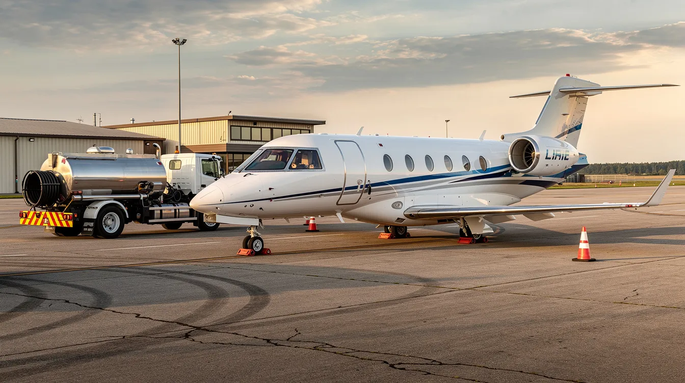
Fuel: Jet A and 100LL avgas available (self-service avgas option)
FBO services: transient parking (tie-downs and hangar space), airframe and powerplant maintenance, pilot amenities during attended hours
Weather: AWOS-3PT broadcasts on 126.575, providing real-time wind, ceiling, visibility, and altimeter data
Ramp access available for transient aircraft; contact the FBO at 260 356 8515 or 260 454 1927 for after-hours arrangements
Important for pilots: deer have been reported in the vicinity of the airport, especially during morning and eve hours (invof arpt spcly morning and evening). Trees near runway thresholds at both ends may affect obstruction clearance on approach. Always check NOTAMs before departure.
Instrument procedures define how aircraft safely navigate during low visibility conditions - fog, low ceilings, snow, or heavy rain. For private charter travelers flying into Huntington Municipal Airport, these procedures determine whether the airport is accessible under instrument flight rules (IFR) or whether crews must divert to an alternate field. Understanding this helps set realistic expectations about weather-related delays or route changes.
FAA instrument procedures for KHHG are published in specific cycles. For example, a recent cycle ran from 01 October 2026 at 0901Z to 29 October 2026 at 0900Z (Cycle 2610). These charts are subject to change with each new cycle, and pilots must always use current, official FAA charts rather than informal summaries. Any publicly referenced procedures are provided only to give travelers a general sense of the airport's IFR capability and are not for navigation.
KHHG has published RNAV (GPS) instrument approach procedures for both Rwy 10 and Rwy 28, plus a VOR-A (non-runway-specific) approach
There is no ILS (Instrument Landing System) at KHHG - all approaches are GPS-based, which means approach minimums for ceiling and visibility are higher than at airports with precision ILS approaches
In practical terms, if ceilings drop below RNAV GPS minimums (typically around 400–500 ft AGL depending on the procedure and aircraft category), charter crews will divert to an alternate
When ceilings or visibility at Huntington fall below minimums, charter crews commonly plan Fort Wayne International Airport (KFWA) as an alternate. KFWA offers ILS approaches with lower minimums, longer runways, and full-service facilities suitable for a wider range of aircraft.
Jettly's partner operators factor real-time METAR and TAF weather data, NOTAMs, and runway condition reports into every flight plan to and from KHHG, and tools like Jettly's jet card flight cost estimator help travelers understand pricing impacts of routing and weather-related changes
The AWOS-3PT at the field (126.575) provides continuous automated weather updates, giving crews the latest information before committing to an approach
Huntington BOAC (Basic/Obstacle Assessment Chart) data and obstacle information are reviewed as part of standard pre-flight planning
For charter clients, the key takeaway is straightforward: GPS approaches at KHHG handle most weather conditions, but very low ceilings or dense fog may require landing at a nearby alternate and completing the trip by ground. For longer itineraries that extend beyond the region, resources explaining how private jets fly internationally can clarify what’s possible from your chosen departure airport. Your charter operator handles all of this planning seamlessly.
Travelers using Huntington Municipal Airport can also consider several nearby airports for alternate routings, aircraft positioning, or operations requiring longer runways. Using Jettly's airport locator tool and [searching flights from nearby airports](LINK 4) can sometimes unlock better pricing or aircraft availability, especially for larger cabin jets that exceed KHHG's runway or weight limits.
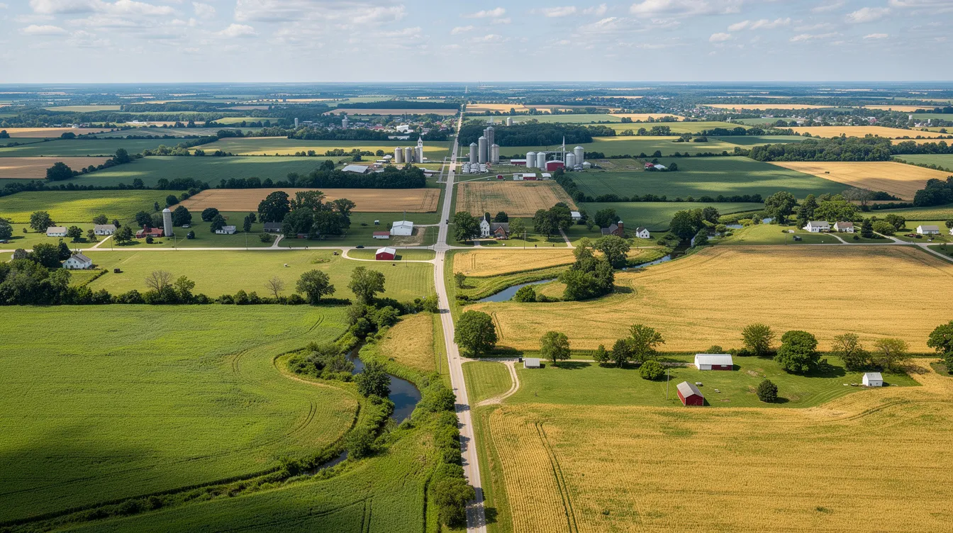
Fort Wayne International Airport is the closest major airport, located approximately 17 miles northeast of Huntington with an estimated driving time of 30–35 minutes. FWA features runways over 11,000 ft, making it suitable for heavy cabin jets, transcontinental flights, and international arrivals with customs service. It's the default alternate for weather diversions and the preferred departure point for longer-range private flights.
Wabash Municipal (KIWH): Light GA and training; close proximity to Huntington
Smith Field (KSMD): Fort Wayne area, primarily light GA and flight training
Marion Municipal (KMZZ): Regional business aviation; runway supports turboprops and some light jets
Warsaw Municipal (KASW): Small business aviation; convenient for Kosciusko County access
Peru Municipal (I76): Light GA operations
De Kalb County (KGWB): Northeast of Fort Wayne, light to midsize GA
Kokomo Municipal (KOKK): Regional business traffic south of Huntington
Grissom Air Reserve Base (KGUS): Military facility with substantial runway infrastructure; limited civilian use but sometimes available for positioning or alternates
Van Wert County (KVNW): Light GA across the Ohio border
A business traveler charters a light jet (e.g., Citation CJ2) via Jettly into KHHG for a morning meeting at a manufacturing facility in Huntington. After a half-day of site visits, the aircraft repositions to Fort Wayne International (FWA) in the eve for a transcontinental private flight - taking advantage of KFWA's longer runways and broader aircraft availability for the next leg, while the traveler relies on a guide to understand how much private jets cost when comparing routing options.
Huntington Municipal Airport's 5,003-foot asphalt runway supports light jets, turboprops, and piston aircraft commonly used in private charter, such as Citation CJ series, Learjet 35/45, King Air 350, and Pilatus PC-12.
No, KHHG is an uncontrolled airport. Pilots use the common traffic advisory frequency (CTAF) to communicate and coordinate arrivals and departures.
Yes, KHHG offers RNAV (GPS) approaches for both runway ends and a VOR-A approach. However, there is no ILS system, so minimums are higher than precision approaches.
Yes, Jettly provides instant pricing and booking for private jet charters to and from Huntington Municipal Airport, with access to over 20,000 aircraft.
Empty leg flights are discounted private jet segments when the aircraft returns empty after a booked trip. Travelers can book these flights last minute or in advance, potentially saving significantly on private travel to or from KHHG.
The airport is about 3 miles southeast of downtown Huntington, roughly a 10–12 minute drive via State Road 5. Ground transportation options can be arranged in advance.
Choose KHHG for direct access to Huntington, minimizing ground travel time. For longer-range flights, larger jets, or international travel requiring customs, nearby Fort Wayne International Airport (KFWA) is preferable.
The airport offers Jet A and 100LL avgas, including a self-service avgas option, supporting a range of private and general aviation aircraft.
Yes, KHHG is open 24 hours, but FBO and service attendance is limited to specific hours: Monday–Saturday 0800–1700, Sunday 1200–1700 local time.
The airport broadcasts an AWOS-3PT automated weather service on frequency 126.575, providing real-time information on wind, visibility, ceiling, and altimeter settings.
Learn more about Jettly's charter options at https://www.jettly.com.
Ready to experience private travel on your terms? Explore flight options or request a quote at https://www.jettly.com.
From Huntington Municipal Airport to downtown Huntington takes roughly 10–12 minutes by car, covering about 3 miles via State Road 5. The airport's position between Fort Wayne and Indianapolis, with proximity to Interstate 69, makes ground transport to local hotels, business parks, and industrial zones straightforward. Travelers who prioritize onboard experience can further customize trips with in-flight catering for private jets. The city has positioned the airport as a strategic asset for economic development and regional access.
Northeast Indiana hosts a range of nearby events and activities that draw private travelers into the region. These include regional business conferences in Fort Wayne, college sporting events, agricultural showcases, seasonal fairs, and industrial site visits. Travelers focused on individual seats rather than whole-aircraft charter can review options on how to buy a seat on a private jet when planning trips around these events. For time-sensitive business trips or family visits, flying directly into KHHG avoids the congestion and scheduling limitations of larger commercial airports.
Jettly's platform provides access to a global inventory of over 20,000 aircraft, covering turboprops, light jets, midsize jets, and heavy cabin types - this private charter aircraft network supports routes into fields like KHHG
For Huntington, frequent matches include the Citation CJ series, King Air 300/350, PC-12, and Learjet 45 - aircraft that comfortably operate within KHHG's 5,003 ft runway. Learn more in the Aircraft Charter Guide
Private jet charter provides instant pricing and booking options through Jettly's platform, and digital booking is a key feature of the service - no phone tag, no waiting for quotes
Empty leg flights occur when a jet returns empty after a booked trip, and they offer significant savings on private jet travel. Travelers can book empty leg flights at discounted rates, and these flights can be booked last minute or in advance. If an aircraft is repositioning through northeast Indiana, an empty leg into or out of KHHG can represent a substantial discount. Check current private jet charter costs or use the charter cost estimator to compare pricing.
Chartering a private jet allows for greater travel flexibility, and choosing the right airport is part of that equation. Private jet charter is popular among high-net-worth individuals and corporate travelers who value direct access over hub convenience, and many use tips for booking the cheapest private jet flights to keep costs in check while prioritizing convenience.
Choose KHHG when your destination is Huntington itself - site visits, plant tours, family travel, or meetings where minimizing ground time is the priority
Choose KFWA when you need longer-range flights, heavier aircraft, or international connections that require customs and longer runways, especially if you plan to get a seat on a private jet easily for onward travel
For affordable options, compare both airports on Jettly's page to see which routing delivers the best value for your itinerary
Whether you're flying into Huntington for a half-day of meetings or staging a multi-leg trip across the Midwest, KHHG gives charter travelers direct access to northeast Indiana without the detour of a major hub. Flyers who want predictable pricing and perks might pair routes like this with Jettly’s jet card programs. Jettly handles the aircraft matching, weather planning, and ground logistics so you can focus on the reason you're traveling.
Learn more about Jettly's charter options at https://www.jettly.com.
Ready to experience private travel on your terms? Explore flight options or request a quote at https://www.jettly.com.
Share this post:
Jeff Ryan Serevilla
Oct 22, 2026
|
5
min read
Discover tips and trends in the industry.

5
min read
Dallas Helicopter Ride and Dinner: How to Plan an Unforgettable Night in the Sky
Experience the magic of Dallas from above with a helicopter ride followed by a delightful dinner. This unique package offers breathtaking views of the city skyline, making it perfect for romantic evenings or special celebrations. With options for custom routes and dining experiences, planning an unforgettable night in the sky has never been easier.
Read More
5
min read
Zimex Aviation: Specialist Missions, Fleet, and Career Opportunities
Zimex Aviation, established in 1969, specializes in flying to remote and challenging environments where conventional airlines often cannot operate. With a diverse fleet of turboprop aircraft, Zimex provides essential services such as oil and gas logistics, humanitarian airlift, and express cargo. The company emphasizes safety and operational excellence, making it a key player in the global logistics and humanitarian support sectors.
Read MoreStay updated with our latest insights and tips to elevate your journey with us.
MEMBERSHIPS AND ASSOCIATIONS



Disclaimer: Jettly operates as a charter broker, offering access to a global digital jet charter marketplace. Jettly is not a direct air carrier and does not own or operate aircraft. All advertised flights are conducted by third-party air carriers that are fully licensed and hold the appropriate Part 135 or Part 121 certifications issued by the Federal Aviation Administration (FAA) or equivalent regulatory authorities under U.S. or foreign law. Jettly complies fully with the U.S. Department of Transportation's Part 295 and Part 298 Charter Broker regulations. Jettly does not carry additional liability insurance. Passengers are covered by aircraft operator insurance. TICO: 50023770


